Quick Links
- Network Map
- List of Stations
- Monthly Report Card
- Quarterly Report Card
- Network Status Page
- Potsdam CPF time bias service
- Procedure for estimating laser beam divergence
- Recent Station Upgrades
- Network station application form
- Revised ILRS station screening process at ILRS Operations Centers (NASA and EDC)

Mt. Stromlo: Meteorological Data
| type | for the past year | since 2000 |
|---|---|---|
| Temp. | no information | 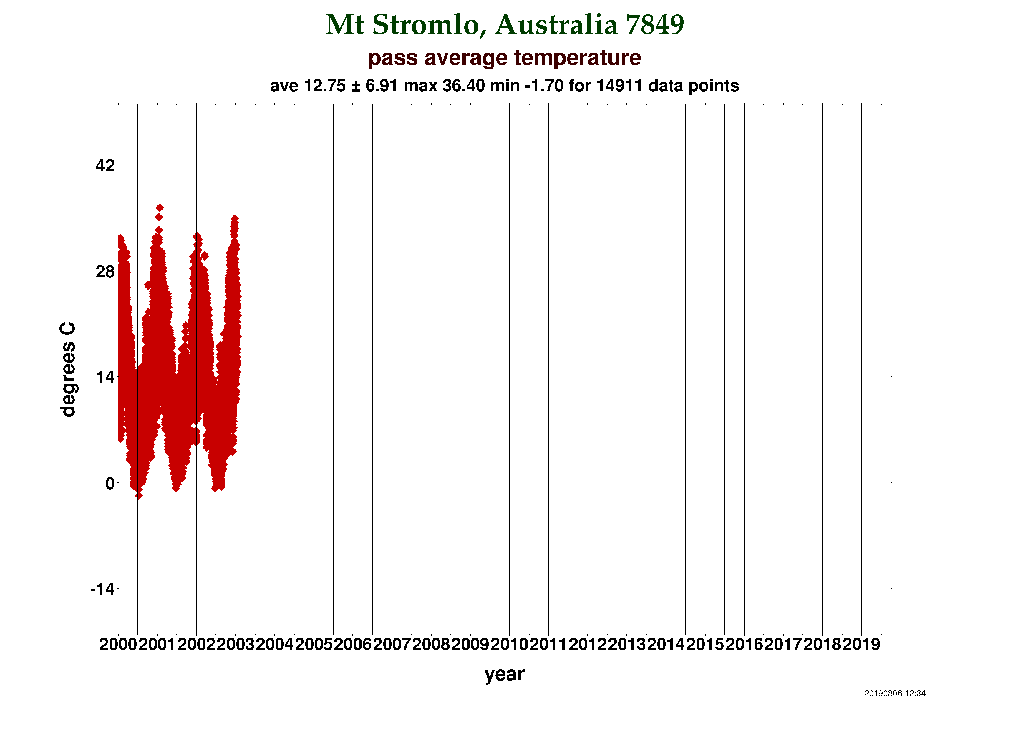 |
Humid. | no information | 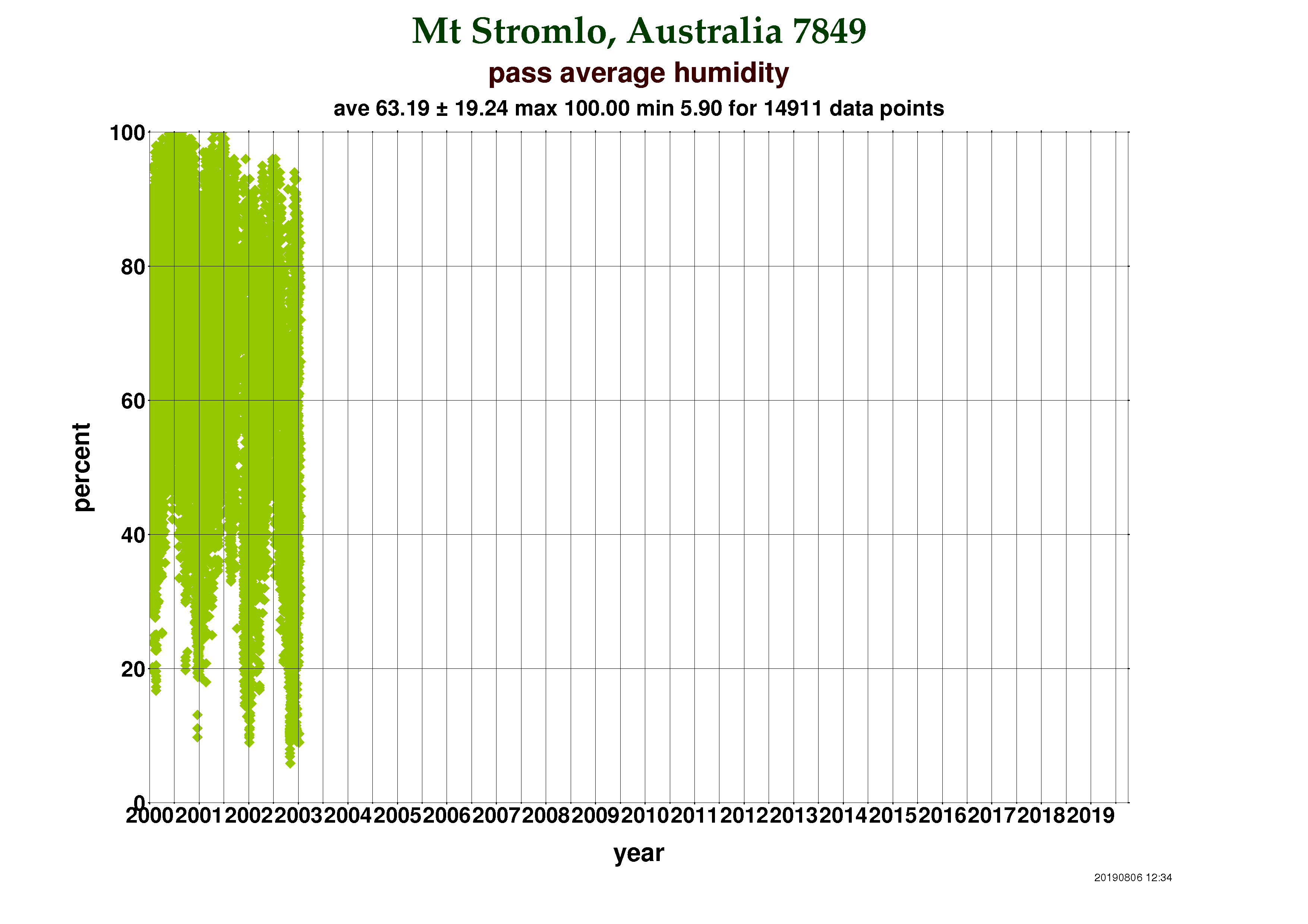 |
| Pres. | no information | 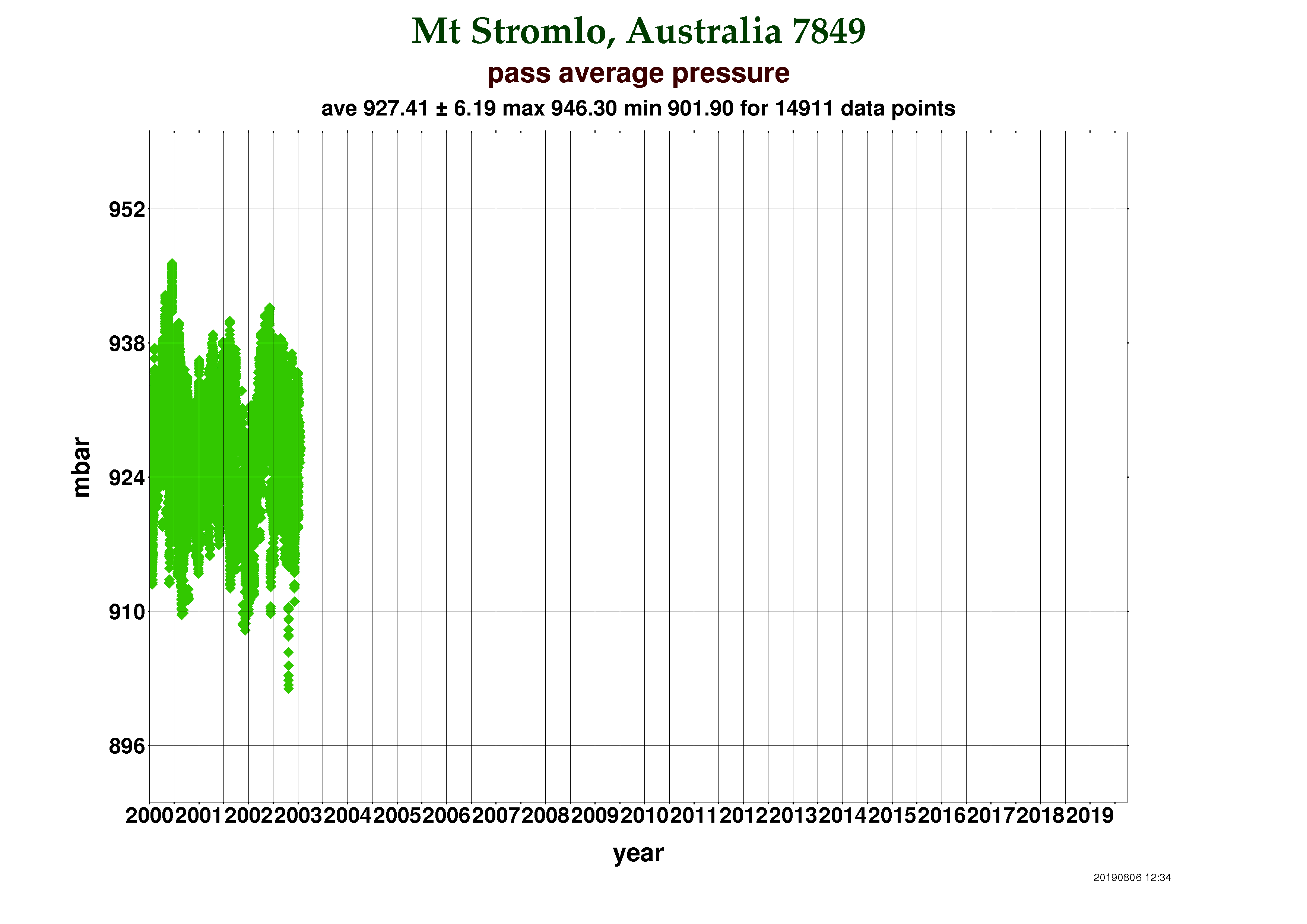 |
Note: For a larger view, please select a thumbnail.

- NASA Official: Frank Lemoine
- Web Developers: 610 Web Dev
- Contact Us
- Last modified date: Sep 4, 2019
- Privacy Policy & Important Notices