ILRS Logo, International Laser Ranging Service

International Laser Ranging Service

A service of the International Association of Geodesy

Search:

IAG | GGOS

Skip Navigation (press 2)
  • About ILRS
    • Recent News
    • Meetings
    • Organization
    • Terms of Reference
    • Membership
    • ILRS Workshops
    • Publications & Reports
    • Links
    • Early History of ILRS
  • Network
    • List of Stations
    • Site Information
    • Site Procedures
    • System Performance
    • Networks and Engineering Standing Committee
    • Space Debris Study Group
    • Quality Control Board
  • Missions
    • List of Missions
    • Spacecraft Parameters
    • Mission Support
    • Mission Operations
    • Missions Standing Committee
  • Science
    • Analysis Centers
    • Analysis Products
    • Analysis Standing Committee
    • Bibliography
    • Data Analysis Resources
    • LARGE Study Group
    • Quality Control Board
    • Science Contributions
    • Scientific Meetings
    • SLR Science Campaigns
      • Galileo for Science
  • Data & Products
    • Data Centers
    • Data
    • Products
    • Predictions
    • Formats
    • Data Center Operations
    • Data Formats and Procedures Standing Committee
  • Technology
    • Laser Ranging
    • Ground Segment
    • Space Segment
    • Modeling
    • Software
    • Network and Engineering Standing Committee
    • Transponder Standing Committee
  • List of Stations
    • Active Stations
      • Overview of new station plots
    • Engineering Stations
    • Closed/Inactive Stations
    • Future Stations
  • Site Information
  • Site Procedures
  • System Performance
  • Networks and Engineering Standing Committee
  • Space Debris Study Group
  • Quality Control Board

Quick Links

  • Network Map
  • List of Stations
  • Monthly Report Card
  • Quarterly Report Card
  • Network Status Page
  • Potsdam CPF time bias service
  • Procedure for estimating laser beam divergence
  • Recent Station Upgrades
  • Network station application form
  • Revised ILRS station screening process at ILRS Operations Centers (NASA and EDC)
metdata navigation structure General Site Log Meteorological Data LAGEOS Performance Satellite Data Info

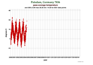
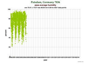
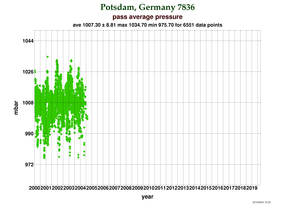
Potsdam: Meteorological Data

type for the past year since 2000
Temp. no information Temperature at Potsdam
Humid. no information Humidity at Potsdam
Pres. no information Pressure at Potsdam

Note: For a larger view, please select a thumbnail.

NASA Logo, National Aeronautics and Space Administration
  • NASA Official: Frank Lemoine
  • Web Developers: 610 Web Dev
  • Contact Us
  • Last modified date: Sep 4, 2019
  • Privacy Policy & Important Notices
WDS logo IAG-GGOS logo