Quick Links
ILRS Workshop 2005
Observations Toward mm Accuracy
October 3-7, 2005
Eastbourne UK
Matthew Wilkinson, SGF Herstmonceux
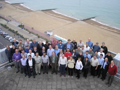
The NERC Space Geodesy Facility hosted the 2005 ILRS Technical Workshop in October at the T&G Centre in the seaside town of Eastbourne in the UK. An ambitious program covering all aspects of Satellite Laser Ranging was tabled to offer every opportunity for constructive discussion.
Away from the Conference Centre, delegates were treated to an evening tour of the NSGF and a reception in the Science Centre, which is also located in the grounds of Herstmonceux Castle. The Workshop opened with a short welcoming ceremony and included addresses from the Mayor of Eastbourne Cllr Graham Marsden, from Dr Mike Pearlman, the Director of the ILRS Central Bureau and from Dr Werner Gurtner, Chair of the ILRS Governing Board.
The workshop website contains presentations and session summaries in full at http://sgf.rgo.ac.uk/sgf-old/workshop2005/workshop2005.html.
The Analysis Working Group met preceding the opening of the Workshop. Early results from the IERS combination work towards ITRF2005 were presented and it was agreed that analysis be done with a consistent strategy. Much discussion was had on range bias and it was decided that the core stations Graz, Greenbelt, Hartebeesthoek, Herstmonceux, McDonald, Monument Peak, Mt Stromlo, Riyadh, Wettzell, Yarragadee and Zimmerwald should have no bias values estimated.
The Analysis session included the network and tracking statistics, as well as a summary of the ongoing, weekly, AWG “pos+eop” project. Discussed was how feedback from the regular analyses that identified, for example, a problem with a station’s data, should be communicated to the station and to other interested components in the community. It was clear also that the analysis community in particular should be much more aggressive in voicing its opinion on the current reduction in global tracking caused by closure of important stations and by reduced shift patterns. An analysis of the error budget of SLR observations highlighted that the most important systematic errors continue to be refraction and satellite/station signature. The session concluded with a brief presentation of a CODE analysis of a manoeuvre of GPS-35, which was observed by station Herstmonceux.
A Site Stability session focussed on the need for accurate station ground surveys for both accurate ranging (target distances and eccentricities) and inter-technique vectors (reference systems). There are missing or poor standard ties at some of the collocated sites and also sites that have not been resurveyed after significant earthquakes. Examples of the current survey status were presented on Mt Stromlo, Hartebeesthoek, Matera, Wettzell, Riga, Herstmonceux and some of the NASA stations.
The System Operations sessions began with a summary of the ILRS Network and the performance of some of its individual stations. Methods were discussed to advance SLR capabilities and improve data yield from high-orbiting satellites by, for example, detecting backscatter from the laser beam in daylight and improving mount models by daytime star calibration.
The Timer Linearity session demonstrated that some of the interval counters used by SLR stations must in time be replaced with epoch timers if we truly wish to have 1mm systems. Stations presented experiments using movable targets that investigated the uncertainties in calibration values and recent technological developments were discussed.
A QC session found errors in the resubmission of passes, 'spikes' in post-fit residuals, constant trends in station residuals due to range bias or time bias and the use of the wrong information. A summary of the responses to the Quality Control questionnaire was opened to discussion from the floor to include other stations. It was found that there is a variety of different techniques that stations use to monitor and control their transmit and receive energy levels and not all stations reduce their data in the same way.
The Satellite Signature session considered the signatures of future satellite missions such as, LARES, Hollow reflectors and a Russian “zero signature” satellite. For any satellites a CoM correction value is dependent on the return intensity as demonstrated by High -Low tests performed at Yarragadee and Zimmerwald. These tests were recommended to all stations to quantify the energy effect. CoM corrections for most of the current satellites has been made available at the ILRS website.
A Restricted Tracking session heard from stations that had successfully upgraded their systems to track satellites that must not be tracked for the full pass. The Control Files session included the Engineering Data File and a summary of the control files routinely shared between stations, the ILRS and its customers to improve overall performance.
The kHz Ranging session reported the experiences of the Graz station and the many improvements in its operation as a result of working at kHz rates. SLR2000 development is progressing and has achieved LEO tracking. Herstmonceux has installed a High-Q Laser and is in the process of installing an event timer towards its kHz ranging goal.
The New Prediction session described implementation of the Consolidated Prediction Format at prediction centres and, as a test, at two of the stations. The benefits of the CPF for improved acquisition were emphasized. The Network Collaboration session stressed the cooperative nature of the ILRS and gave the advent of dynamic priorities, unification of IRVS, time bias functions and the Eurolas realtime-tracking display as examples of this.
The final sessions covered the future applications of SLR, including Transponder missions and Time Transfer by T2L2 on Jason-2, and the additional applications of SLR systems, including photometry and Astrometry.
The Workshop closed with the 2005 ILRS General Assembly, which featured session summaries and reports on progress from the Working Group coordinators.
Resolutions
ILRS General Assembly, Eastbourne, UK, October 7, 2005
- Recognizing the degradation of SLR products including EOP,
POD, etc, that occurs as a result of the lapse of data suffered
during weekends (especially Sundays):
The ILRS requests that all stations strive toward 24 –7 operations. In the meantime, stations should make every effort to expand operations to include at least one shift of operations on Saturdays and Sundays. - Recognizing the essential role of accurate ground survey at
each station for both ground control (including ground targets)
and inter-technique vectors in the quality of the ranging data
and the terrestrial reference system:
The ILRS reminds stations that they have the responsibility of assuring that ILRS mandated ground surveys are conducted, analysed, and properly reported at the prescribed quality and frequency. - Recognizing the importance of (a) improved predictions accuracies
and (b) the need to go to extended ranges (transponders, etc),
the ILRS will transition to Consolidated Prediction Format (CPF)
by mid-2006 and therefore:
The ILRS recommends that stations transition to the CPF in an expeditious manner. - Recognizing the severe lack of global distribution
in the laser ranging network:
The ILRS urges stations and operating groups to consider relocating laser ranging stations from densely occupied areas to areas without coverage. - Recognizing the need to reach 1 mm accuracy ranging:
The ILRS encourages the continued development of zero-signature targets for geodetic satellites. - Recognizing the need for mm ranging and operations to targets
at extended range:
The ILRS recommends that stations strongly consider including event timers in their upgrading plans. - Recognizing the importance of bias-free SLR data to the quality
of the ILRS data products:
The ILRS requests that all laser stations strive to reduce variable systematic effects in their range measurements. - Recognizing the limitations imposed by the atmospheric refraction
on the ultimate accuracy of laser ranging and that the Matera Laser
Ranging Station is in a unique position to pursue two- wavelength
refraction recovery studies:
The ILRS strongly recommends that the Matera Station continue two-wavelength studies with the intent of verifying refraction recovery to an accuracy of better than 1 mm. - Recognizing the current dearth of both high satellite and lunar
ranging data:
The ILRS requests that the Matera Station put special emphasis on high satellites and lunar ranging to help fill the current severe void in these areas. - Recognizing the lack of lunar ranging data in the Southern
Hemisphere:
The ILRS strongly supports the activities of the Hartebeesthoek Observatory toward the implementation of Lunar Ranging in South Africa and cooperative plans with other organizations that may help to provide hardware and other support. - Considering the importance of (a) locating geodetic observatories
in the Southern Hemisphere and (b) colocating three or more geodetic
techniques for the development and implementation of the Terrestrial
Reference Frame:
The ILRS strongly supports the continued development and operation of the TIGO system in Concepción. - Recognizing the recent significant progress in the development
of SLR2000 and the potentially significant improvement in network
capability offered by this system:
The ILRS urges NASA to bring the prototype system to fruition as soon as practically possible. - The ILRS Governing Board endorses and welcomes the EOS/GA organization of the Fifteenth International Workshop in Canberra, Australia, on October 16 – 20, 2006 and encourages ILRS members to participate.
- The ILRS recognizes the very important work done by the Refraction Study Group and expresses its appreciation to Stefan Riepl for his leadership of the Study Group.
- The ILRS and the meeting participants express their sincere gratitude to the NERC Space Geodesy Facility at Herstmonceux and the organizers of the Eastbourne Workshop for their kind hospitality and wonderful arrangements.
