SLR Supports Study of Atmosphere-Hydrosphere-cryosphere-Solid Earth Interactions
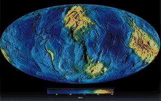
Twenty-five years of SLR data on 15 satellites equipped with corner-cube retroreflectors has provided the standard, highly accurate, long wavelength gravity field reference model which supports all precision orbit determination and provides the basis for studying temporal gravitational variations due to mass redistribution.
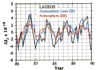
From temporal changes in the gravity field, SLR measures the effects of mass redistribution in the atmosphere-hydrosphere-cryosphere-solid earth system. Over multi-year time scales, SLR provides an independent verification of the mass redistribution implied by global atmospheric circulation models used to predict global climate change.
Post-Glacial Rebound
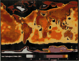 Over the last 12,000 years, the Earth’s crust has been rebounding from the effects of deglaciation, that is, the melting of the ice sheets associated with the last ice age. Detailed knowledge of the rebound is required for proper interpretation of sea level data acquired globally at tide gauge stations. Tide gauges provide relative measurements of sea height with respect to a neighboring point on the Earth’s crust, which itself may be undergoing vertical motion. SLR and other space geodetic systems contribute to the solution of this problem by determining the amount of vertical motion experienced by these sites.
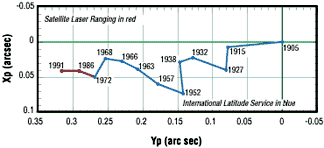 Post-glacial rebound and long term changes in ice sheet mass balance create secular changes in Earth pole position which has been monitored continuously using SLR over the last two decades.
