
Geo-IK-2
Jump to: Mission Objectives, Mission Instrumentation, Mission Parameters, Additional Information
Mission Photos:
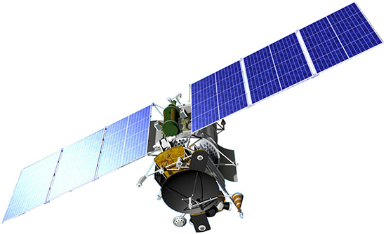
The circa 2015 depiction of the Geo-IK-2 (Musson-2; 14F31) satellite in deployed position in orbit. Credit: ISS Reshetnev
The Geo-IK-2 satellite is a follow-on geodesy mission to the GEO-IK series. It has the following instruments:
- SADKO radar altimeter
- Laser retro reflectors
- GLONASS and GPS receiver
Mission Objectives:
- construction of high-precision geodetic network in the geocentric coordinate system (reference frame);
- determination of the Earth's gravitational field parameters
- determination of continental plates movements;
- determination of the earth tide;
- determination of changes in the Earth's rotation speed and pole coordinates, solution of a number of applied problems that require the operative determination of the coordinates of ground stations, including:
- creation of regional geodetic networks;
- remote sensing of the Earth;
- the definition of the marine geoid;
- ice monitoring.
Satellite laser ranging will be used for Precise Orbit Determination (POD).
Geo-IK-2 Mission Parameters:
| Satellite | Geo-IK-2 |
| Sponsor: | JSC ARADEMISIAN M.F. RESHETNEV Information Satellite Systems (JSC ISS) |
| Expected Life: | 1 year |
| Primary Applications: | Construction of high-precision geodetic network; Earth remote sensing |
| Primary SLR Application: | Precision orbit determination |
| Launch Date: | June 4, 2016 |
| COSPAR ID: | 1603401 |
| SIC: | 5561 |
| NORAD: | 41579 |
| NP Bin Size: | 30 |
| RRA Diameter: | |
| RRA Shape: | Two-cone |
| Reflectors: | |
| Orbit: | |
| Inclination: | 99.47 degrees |
| Eccentricity: | 0.001 degrees |
| Perigee: | 958.5±15 km |
| Period: | 6216.5 sec |
Additional Information:
Web sites:
