
IRNSS
Jump to: Mission Objectives, Mission Instrumentation, Mission Parameters, Additional Information
Mission Photos:
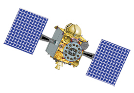
Courtesy of ISRO
Mission Objectives:
The Indian Regional Navigation Satellite System (IRNSS) consists of a constellation of seven satellites and a ground segment for positioning and timing applications. IRNSS is under development by the Indian Space Research Organisation (ISRO). INRSS will include three satellites in geostationary orbit and four satellites in geosynchronous orbit, transmitting L-band and S-band signals and providing coverage primarily for the Indian land mass.
SLR tracking data will be used for orbit determination and calibration of the orbit determined from other sources.
Notes:
- IRNSS-1H had a launch failure on August 31, 2017.
- IRNSS-1G does not have a retroreflector array.
Mission Instrumentation:
IRNSS satellites will have the following instrumentation onboard:
- Atomic clocks
- L and S-band transmitters
- Retroreflector array
Mission Parameters:
| Satellite: | IRNSS-1A | IRNSS-1B | IRNSS-1C | IRNSS-1D |
| Sponsor: | ISRO | ISRO | ISRO | ISRO |
| Expected Life: | 10 years | 12 years | 12 years | 12 years |
| Primary Applications: | Positioning and timing | Positioning and timing | Positioning and timing | Positioning and timing |
| Primary SLR Applications: | Orbit determination | Orbit determination | Orbit determination | Orbit determination |
| COSPAR ID: | 1303401 | 1401701 | 1406101 | 1501801 |
| SIC Code: | 3301 | 3302 | 3303 | 3304 |
| NORAD SSC Code: | 39199 | 39635 | 40269 | 40547 |
| Launch Date: | July 1, 2013 | April 4, 2014 | October 15, 2014 | March 27, 2015 |
| NP Bin Size: | 300 seconds | 300 seconds | 300 seconds | 300 seconds |
| RRA Shape: | Hexagon | Hexagon | Hexagon | Hexagon |
| Cube Diameter: | 38 mm | 38 mm | 38 mm | 38 mm |
| Reflectors: | 40 corner cubes | 40 corner cubes | 40 corner cubes | 40 corner cubes |
| Inclination: | 29.3 degrees | 30.57 degrees | 4.78 degrees | 30.43 degrees |
| Longitude: | 55.0 degrees East | 55.0 degrees East | 83.0 degrees East | 111.75 degrees East |
| Eccentricity: | 0.0002 | 0.0002 | 0.0002 | 0.0002 |
| Apogee: | 35,882.7 km | 35,870 km | 35,889 km | 35,884.1 km |
| Perigee: | 35,706.1 km | 35,714 km | 35,697 km | 35,750 km |
| Satellite: | IRNSS-1E | IRNSS-1F | IRNSS-1G | IRNSS-1H |
| Sponsor: | ISRO | ISRO | ISRO | ISRO |
| Expected Life: | 12 years | 12 years | 12 years | 12 years |
| Primary Applications: | Positioning and timing | Positioning and timing | Positioning and timing | Positioning and timing |
| Primary SLR Applications: | Orbit determination | Orbit determination | Orbit determination | Orbit determination |
| COSPAR ID: | 1600301 | 1601501 | 1602701 | 1705101 |
| SIC Code: | 3305 | 3306 | 3307 | 3308 |
| NORAD SSC Code: | 41241 | 41384 | 41469 | 42928 |
| Launch Date: | January 20, 2016 | March 10, 2016 | April 28, 2016 | August 31, 2017 |
| NP Bin Size: | 300 seconds | 300 seconds | N/A | |
| RRA Shape: | Hexagon | Hexagon | N/A | Hexagon |
| Cube Diameter: | 38 mm | 38 mm | N/A | 38 mm |
| Reflectors: | 40 corner cubes | 40 corner cubes | N/A | 40 corner cubes |
| Inclination: | 28.09 degrees | 32.5 degrees | 4.2537 degrees | |
| Longitude: | 111.75 degrees East | 32.5 degrees East | 129.5 degrees East | Launch Failure |
| Eccentricity: | 0.0002 | 0.0002 | ||
| Apogee: | 35,882.8 km | 35,876 km | 35,796.20 km | |
| Perigee: | 35,706.5 km | 35,711.5 km | 35,780.96 km |
| Satellite: | IRNSS-1I | IRNSS-1J |
| Sponsor: | ISRO | ISRO |
| Expected Life: | 12 years | 12 years |
| Primary Applications: | Positioning and timing | Positioning and timing |
| Primary SLR Applications: | Orbit determination | Orbit determination |
| COSPAR ID: | 1803501 | 2307601 |
| SIC Code: | 3309 | 3310 |
| NORAD SSC Code: | 43286 | 56759 |
| Launch Date: | April 11, 2018 | May 29, 2023 |
| NP Bin Size: | 300 seconds | 300 Seconds |
| RRA Shape: | Hexagon | Hexagon Array |
| Cube Diameter: | 38 mm | 40.4 mm |
| Reflectors: | 40 corner cubes | 40 corner cubes |
| Inclination: | 28.8 degrees | 5.0 degrees |
| Longitude: | 55.0 degrees East | 129.55 degrees East |
| Eccentricity: | 0.0002 | 0.0002 |
| Apogee: | 35,873.8 km | 35,790 km |
| Perigee: | 35,713.9 km | 36,000 km |
Additional Information:
- ISRO (India Space Research Organization) IRNSS (India Regional Navigational Satellite System) web page
- IGS Mult-GNSS Experiment (MGEX) webpage for IRNSS (NAVIC)
Publications:
- Kogure, S., Ganeshan, A., Montenbruck, O. (2017)."Regional Systems". In: Teunissen, P.J., Montenbruck, O. (eds) Springer Handbook of Global Navigation Satellite Systems. Springer Handbooks. Springer, Cham. doi: 10.1007/978-3-319-42928-1_11
- O. Montenbruck, P. Steigenberger, S. Riley. "IRNSS Orbit Determination and Broadcast Ephemeris Assessment." (c) Institute of Navigation. Presented at ION ITM 2015, Dana Point, CA, 26-28 Jan 2015.
- Porcelli L., Bori A., Ciocci E. et al. (2017). "Thermo-optical vacuum testing of IRNSS laser retroreflector array qualification model", Adv. Space Res., 50(5), 1054–1061, doi: 10.1016/j.asr.2017.05.012
- Rajaiah K., Manamohan K., Nirmala S., Ratnakara S.C. (2017). "Modified empirical Solar Radiation Pressure model for IRNSS constellation", Adv. Space Res., 60(10), 2146–2154, doi: 10.1016/j.asr.2017.08.020
- Santra A., Mahato S., Mandai S. et al. (2019). "Augmentation of GNSS utility by IRNSS/NavIC constellation over the Indian region", Adv. Space Res., 63(9), 2995–3008, doi: 10.1016/j.asr.2018.04.020
- Steigenberger P., Montebruck O., Bradke M., Ramatschi M. Hessels U. (2022). "Evaluation of earth rotation parameters from modernized GNSS navigation messages", GPS Solutions, 26(2), 50, doi: 10.1007/s10291-022-01232-4
- Zaminpardaz S., Teunissen P.J.G., Nadarajah N. (2019). "IRNSS stand-alone positioning: first results in Australia", J. Spatial Sci., 61(1), 5–27, doi: 10.1080/14498596.2016.1142398
