
ICESat-2
Jump to: Mission Objectives, Mission Instrumentation, Mission Parameters, Additional Information
Mission Photos:
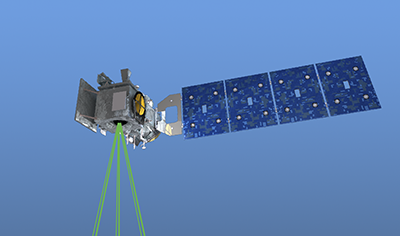
Courtesy of ICESat-2
Science Team
Mission Objectives:
The Ice, Cloud, and land Elevation Satellite -2 (ICESat-2) is part of NASA's Earth Observing System (EOS) program, which includes a series of satellites beginning in 1998 to measure Earth's atmosphere, oceans, land, ice, and biosphere for 15 years.
ICESat-2 Science Objectives:
- Quantifying polar ice-sheet contributions to current and recent sea-level change, as well as ice-sheet linkages to climate conditions.
- Quantifying regional patterns of ice-sheet changes to assess what drives those changes, and to improve predictive ice-sheet models.
- Estimating sea-ice thickness to examine exchanges of energy, mass and moisture between the ice, oceans and atmosphere.
- Measuring vegetation canopy height to help researchers estimate biomass amounts over large areas, and how the biomass is changing.
- Enhancing the utility of other Earth-observation systems through supporting measurements.
Mission Instrumentation:
ICESat-2 has the following instrumentation:
- Advanced Topographic Laser Altimeter System (ATLAS)
- Retroreflector array
Mission Parameters:
| Sponsor: | NASA, United States |
| Expected Life: | 5 years |
| Primary Applications: | ice-sheet elevation change, sea-ice freeboard, and vegetation canopy height |
| Primary SLR Applications: | Satellite Laser Ranging is primarily used as independent validation and quantification of GPS-based precision orbit determination (POD). In addition, SLR is used in combination with GPS data to improve overall POD accuracy. |
| COSPAR ID: | 1807001 |
| SIC Code: | 6873 |
| NORAD SSC Code: | 43613 |
| Launch Date: | September 15, 2018 |
| RRA Diameter: | 31.75mm |
| RRA Shape: | hemispherical/pyramid |
| Reflectors: | |
| Orbit: | |
| Inclination: | 92 degrees |
| Eccentricity: | 0.001398 |
| Perigee: | 496km |
| Period: | 94.16 minutes |
| Weight: |
Additional Information:
Web sites:
Publications:
- Moussavi, M.S., Abdalati, W., Scambos, T., and Neuenschwander, A., "Applicability of an automatic surface detection approach to micro-pulse photon-counting lidar altimetry data: implications for canopy height retrieval from future ICESat-2 data", Int. J. Remote Sens., 35, 5263-5279, 2014
