
SARAL
Jump to: Mission Objectives, Mission Instrumentation, Mission Parameters, Additional Information
Mission Photos:
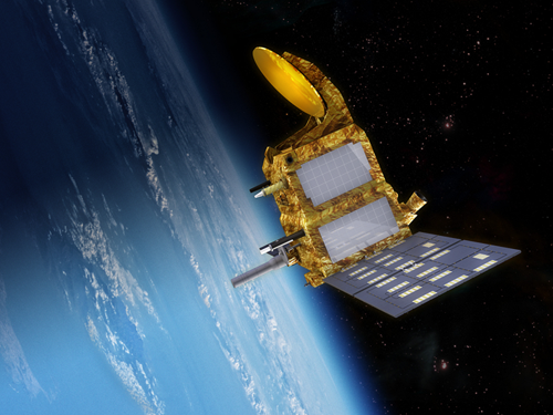
Courtesy of CNES
Satellite with ARgos and ALtika (SARAL) is a cooperative mission between CNES and the Indian Space Research Organization (ISRO) The mission is complemenatary to Jason-2 and will provide observations of ice, rain, coastal zones, and wave heights. SARAL results from the common interests of CNES and ISRO in studying the oceans from space using altimetry and providing maximum use of ARGOS (Advanced Research and Global Observation Satellite), a joint NOAA CNES data collection system.
Mission Objectives:
The main mission objectives of SARAL are to:
- Create precise, repetative global measurements of sea surface height, wave heights, and wind speed
- Ensure continutity of the altimetry service currently available from Envisat and Jason-1/-2
- Contribute to global ocean and climate studies to build a global ocean observing system
These objectives will be accomplished by studying mesoscale ocean variability through observations of:
- coastal areas
- inland waters
- surface of continental ice sheets
Mission Instrumentation:
The SARAL satellite will be provided by ISRO; the mission will have the following instrumentation onboard:
- Altimeter/Radiometer (AltiKa) built by CNES
- DORIS built by CNES
- Laser Retroreflector Array built by CNES
- ARGOS-3 instrument
The DORIS instrument will be used for POD, which is a fundamental requirement for achieving the goals of the SARAL mission. SLR will play an important role by providing strong tracking information to complement DORIS and by providing a unique and unambiguous verification of the absolute radial orbit accuracy.
Mission Parameters:
| Satellite: | SARAL |
| Sponsor: | CNES and ISRO |
| Expected Life: | 5 years (ARGOS); 3 years (AltiKa) |
| Primary Applications: | Earth sensing |
| Primary SLR Applications: | Precision orbit determination |
| COSPAR ID: | 1300901 |
| SIC Code: | 3201 |
| Satellite Catalog (NORAD) Number: | 39086 |
| Launch Date: | Feb 25, 2013 |
| NP Bin Size: | 15 seconds |
| RRA Diameter: | TBD |
| RRA Shape: | Octagonal |
| Reflectors: | 9 corner cubes |
| Inclination: | 98.55 degrees |
| Eccentricity: | 1.165 x 10⁻³ |
| Altitude: | 814 km |
| Weight: | 350-400 kg |
Additional Information:
Web sites:
- CNES SARAL home page
- CNES AltiKa home page
- AVISO home page
- ISRO SARAL home page
Publications:
- Otosaka, I. Shepherd, A. and M. McMillan (2019), "Ice Sheet Elevation Change in West Antarctica From Ka-Band Satellite Radar Altimetry", Geophys. Res. Lett., 46(22), pp. 13135-13143, DOI: 10.1029/2019GL084271
- Tozer, B., Sandwell, D.T., Smith, W.H.F., Olson, C., Beale, J.R. and P. Wessel (2019), "Global Bathymetry and Topography at 15 Arc Sec: SRTM15+", Earth and Space Science, 6(1), pp. 1847-1864, DOI: 10.1029/2019EA000658
- Mertikas, S., Donlon, C., Féménias, P., et al. (2018), "Fifteen Years of Cal/Val Service to ReferenceAltimetry Missions: Calibration of Satellite Altimetryat the Permanent Facilities in Gavdos and Crete, Greece", Remote Sensing, 10(10), 1557, DOI: 10.3390/rs10101557
- Verron, J., Bonnefond, P., Aouf, L., et al. (2018), "The Benefits of the Ka-Band as Evidenced from the SARAL/AltiKa Altimetric Mission: Scientific Applications", Remote Sensing, 10(2), 163, DOI: 10.3390/rs10020163
- Moreaux, G., Lemoine, F.G., Capdeville, H. (2016), "The International DORIS Service contribution to the 2014 realization of the International Terrestrial Reference Frame", Adv. Space Res., 58(12), 2479-2504, DOI: 10.1016/j.asr.2015.12.021
- Zelensky N.P., Lemoine, F.G., Chinn, D.S., et al. (2016), "Towards the 1-cm SARAL orbit", Adv. Space Res. 58(12), 2651-2676, DOI: 10.1016/j.asr.2015.12.011
- Schwatke, C., Dettmering, D., Borgens, E. and W. Bosch (2015), "Potential of SARAL/AltiKa for Inland Water Applications", Marine Geodesy, 38, pp. 626-643, DOI: 10.1080/01490419.2015.1008710
- Verron, J., Sengenes, P., Lambin, J. et al. (2015), "The SARAL/AltiKa Altimetry Satellite Mission", Marine Geodesy, 38, pp. 2-21, DOI: 10.1080/01490419.2014.1000471
