
TerraSAR-X
Jump to: Mission Objectives, Mission Instrumentation, Mission Parameters, Additional Information
Mission Photos:
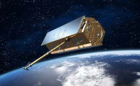
Courtesy of Infoterra
GmbH
Mission Objectives:
TerraSAR-X is an X-band SAR mission for scientific reasearch and applications. It is the first satellite to be built in a public/private partnership in Germany. It carries the experimental Tracking, Occultation and Ranging (TOR) package provided by GFZ and CSR. TOR consists of a two-frequency CHAMP type GPS receiver and a CHAMP Laser Retro-Reflector (LRR).
The mission's objectives are:
- the provision of X-band SAR-data for scientific research and applications as well as
- the establishment of a commercial EO-market and to develop a sustainable EO-service business, based on TerraSAR-X derived information products.
Mission Instrumentation:
TerraSAR-X has the following instrumentation onboard:
- Active phased array X-band SAR
- Tracking, Occultation, and Ranging (TOR) package
- GPS receiver
- Retroreflector array
- Laser Communication Terminal (LCT)
Mission Parameters:
| Sponsor: | Infoterra, DLR, GFZ
(Germany) CSR (U.S.) |
| Expected Life: | 5 years |
| Primary Applications: | research and applications |
| Primary SLR Application: | precision orbit determination |
| COSPAR ID: | 0702601 |
| SIC Code: | 6201 |
| Satellite Catalog (NORAD) Number: | 31698 |
| Launch Date: | June 15, 2007 |
| NP Bin Size | 5 seconds |
| RRA Diameter: | 5 cm |
| RRA Shape: | rectangular |
| Reflectors: | 4 corner cubes |
| Orbit: | sun-synchronous |
| Inclination: | 97.44 degrees |
| Eccentricity: | 0 |
| Perigee: | 514 km |
| Period: | 11 days |
| Weight: | 1,230 kg |
Additional Information:
Web sites:
Publications:
- Arnold, D., Montenbruck, O.., Hackel, S., and K. Sosnica (2019), "Satellite laser ranging to low Earth orbiters: orbit and network validation", J. Geodesy: 93(11), pp. 2315-2334, DOI: 10.1007/s00190-018-1140-4.
- Hackel, S., Gisinger, C., Balss, U., Wermuth, M., and O. Montenbruck (2018), "Long-Term Validation of TerraSAR-X and TanDEM-X Orbit Solutions with Laser and Radar Measurements", Remote Sensing, 10(5), 762, DOI: 10.3390/rs10050762
- Rizzoli, P., Martone, M., Gonzalez, C., et al. (2017), "Generation and performance assessment of the global TanDEM-X digital elevation model", ISPRS Journal of Photogrammetry and Remote Sensing, 132, pp. 119-139, DOI: 10.1016/j.isprsjprs.2017.08.008
- Krieger, K., Zink M., Bachmann, M., et al. (2013), "TanDEM-X: A radar interferometer with two formation-flying satellites", Acta Astronautica, 89, pp. 83-98, DOI: 10.1016/j.actaastro.2013.03.008
- Krieger, K., Moreira A., Fieldler, H., Hajnsek, I., Werner, M., Younis, M., and M. Zin (2007), "TanDEM-X: A Satellite Formation for High-Resolution SAR Interferometry", IEEE Transactions on Geoscience and Remote Sensing, 45(11), 3317 - 3341, DOI: 10.1109/TGRS.2007.900693
